A brief history of the French road network
France's road network has a long and varied history, spanning over 2000 years. Through regime changes, invasions, wars and revolutions, the network went through many peaks and troughs, with periods of growth and development interspersed with phases of neglect and decline. Join us as we take a look how France evolved from mere dirt paths to the asphalt ribbons of the 21st century.
From small acorns grow mighty oaks
For the earliest origins of a road network, we have to go back to a time before the Romans expanded their network. As it wasn't the Romans who first developed a series of paved routes, it was the Gauls who did.
Not happy with the lack of waymarked routes, the Gauls built a network of roads and bridges that would allow extensive trade flows and rapid movement of troops, their vehicles and their luggage.
When Julius Caesar embarked on his six-year campaign to take control of Gaul, he was impressed with the speed that his own soldiers were able to move, all because the road network was already there. The only requirement was for those roads to be upgraded to meet the same engineering standards enjoyed in Italy, and the construction of river bridges as boat crossings were seen as prone to attack. This allowed for a much quicker transit route between Rome and the Iberian territories.
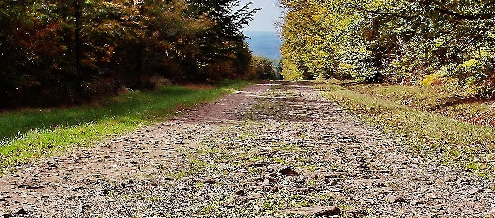
Remains of a Roman road in
Haute-Saone
Construction standards were further improved following the creation of the Roman Empire under the dictatorship of Augustus. New roads were constructed to further connect towns and military bases, which also led to the creation of the Grand Routes, a series of trunk connections across Gaul.
The most notable of these were the Via Julia Augusta, a coastal route bypassing the earlier mountainous Via Domitia (the main Italy - Spain road), and the Via Aquitainia, which linked the regional capital of Narbonne with the west coast.
However, it was Augustus' trusted
son-in-law Agrippa who instigated the foundations of a radial network.
Choosing Lyon as the hub, for purely geographical reasons (being at the
centre of Gaul), four radial trunk routes - the Via Agrippa - were
constructed linking the city with:
- Arles, connecting with the Via Julia Augusta for Spain and
Italy;
- Boulogne-sur-Mer, with branches towards Brittany and Belgium;
- Cologne, at Rhine and the northern extent of the Empire;
- Saintes, on the western Atlantic coast.
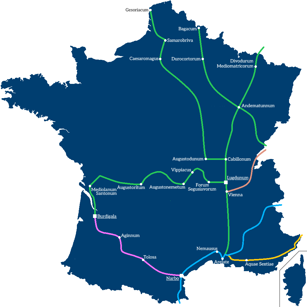
The Augustinian major
route network: Via Domitia = blue, Via Julia Augusta = yellow, Via Aquitania
= purple, Alpis Graia = brown. The Via Agrippa network is in green
A number of other arterial roads were also built to link into the Via Agrippa, as well as act as radial routes such as the road between modern day Bordeaux and Rouen. Meanwhile, the most local of routes saw no improvements, continuing as mere dirt tracks.
By the fifth century, the annexation of much of Gaul by the Franks saw the eventual retrenchment of the Roman Empire and the destruction of ancient civilisation. Many roads were abandoned, the network as a whole seeing rapid decline. Much of the good work carried out by the Romans was undone by those who subsequently invaded the provinces.
| Page 1 | Next >> |
Picture Credits
Roman road is
taken from an original by Espirat and used under
this Creative Commons license
.jpg)